
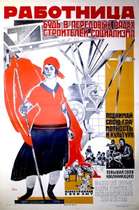
Typolithography of Geokartprom of the V.T.U. (Military Topographic Directorate of the Soviet Army), Moscow
In 1918, the Soviets nationalized the Moscow printing works of brothers Wilhelm Theodor Mehnert and Herman Julius Mehnert at 9 Bol'shaia Polianka (later named Soviet Street). The building housing the printer was first occupied by the Julius Kirsten printing firm. Upon its nationalization, the Soviets placed Mehnert printing under Geokartprom, a State-owed trust of the Commissariat of Defense that centralized government-mapping projects. Geokartprom printed atlases and maps solely for military and government use. While it did map geographic locations within the Soviet Union, it also carried out an enormous mapping project of cities throughout the world. In the 1920s, Geokartprom typolithography in Moscow was named in honor of the Bolshevik leader Evlampii Dunaev (1877-1919).
![PP 339: 8 de Marzo [el Día Internacional de la Mujer], el día del reconocimiento de la lucha de las obreras y campesinas de todo el mundo.](https://www.posterplakat.com/thumbs/the-collection/posters/pp-339/pp339-200x300.jpg)
![PP 597: Sobre los iconos revitalizados y sobre cómo el encargado de un edificio revitaliza a los siempre activos sacerdotes.
[Parte superior izquierda]
Tres arañas campesinas se reúnen para calentarse y tratar sus huesos con vapor alrededor de un samovar enorme.
Las reconocerás cuando las mires. Todas son tus amigas, “el sacerdote simplón, el tendero y la araña regional, el kulak.”
[Traducción parcial]](https://www.posterplakat.com/thumbs/the-collection/posters/pp-597/pp597-200x300.jpg)
![PP 774: [On the top]
The place where cooperation is not respected
[On the bottom]
The place where cooperation works.](https://www.posterplakat.com/thumbs/the-collection/posters/pp-774/pp-774-catalog-image-200x294.jpg)
![PP 861: Lenin y el campesinado.
“El campesino diligente es una figura central de nuestro desarrollo económico.” – Lenin
[Traducción parcial]](https://www.posterplakat.com/thumbs/the-collection/posters/pp-861/pp-861-catalog-image-200x147.jpg)


Fuentes
Drozdov, D.P. (2021). Bol’shaia Polianka: progulka po Zamoskvorech’iu ot malogo kamennogo mosta do serpukhovskoi ploshchadi istoria starinnoi ulitsy ot doma k domu. Moscow: Tsentroligraf. (General history of Bol’shaia Polianka with Menert Brothers cited)
Davies, J., & Kent, A. J. (2017). The Red Atlas: How the Soviet Union secretly mapped the world. Chicago: Univ of Chicago Press. (VTU, pp. 9, 11, 28)
Monmonier, M. (2015). Cartography in the Twentieth Century, Vol. 6. Chicago: University of Chicago Press. (Menert, p. 934)
wikimapia.org (building of Menert- location and history)
Glavnoe upravlenie geodezii i kartografii pri Sovete ministrov SSSR; Voyenno-topograficheskaia sluzhba sovetskoi armii. (1967). 50 let sovetskoi geodezii i kartografii. Moskva: Izdatel’stvo Nedra. (general history of V.T.U., p. 10)